Astronomy
Sentinel-3A sends back first stunning images of Earth
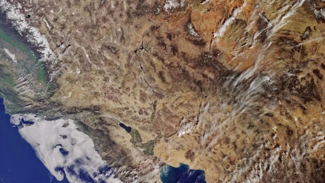
Taking the planet's pulse from space: Europe's Sentinel-3A eco-monitoring satellite sends back its first stunning hi-res images of Earth Sentinel-3A is on a mission to investigate Earth’s oceans, measure colour, temperature and sea levels, and has recently sent back the first batch of pictures. The first test group of images depict the snow-covered archipelago in Svalbard, the Strait of Gibraltar and parts of Europe and the US. This device is part of a large program that aims to understand and monitor the health of Earth’s oceans and land surfaces. Sentinel-3A was first released into orbit on February 16th and is the third of more than a dozen ‘eyes in the sky’ that part of the Copernicus program. The European Space Agency calls ‘the most sophisticated observation system every launched’, reports AP. These new ‘eyes’ will not only capture images of the deep blue see and rolling hills of the world, it will give researchers the ability to monitor areas in real-time. The device is set investigate plants, crop conditions and inland water monitoring with estimates of atmospheric aerosol and clouds. “The mission will be at the heart of a wide range of applications, from measuring marine biological activity to providing information about the health of vegetation,’ said Volker Liebig, ESA’s Director of Earth Observation Programmes. “Given its extensive payload, Sentinel-3A is a real workhorse that is set to make a step change in the variety of data products provided to users.†What makes this technology so impressive, is that it has the ability to scan the entire globe in just a little over a day and send the images within a few hours.
Source: Daily Mail
Thu 3 Mar 2016 at 07:09