Agriculture
Using technology to measure evapotranspiration and maximize water
For producers who want higher yields, there’s an app for that—or a hundred. Yet when farmers want to deploy high-tech conservation practices on their operations, the options are thinner. Still, several digital resources are at your disposal. One is Agren’s SoilCalculator, which estimates erosion and economic effects. It combines color-coded aerial maps of erosion, conservation practices and crop rotations. That lets farmers look at predictive erosion maps so they can see what different management practices do.
“Growers can easily evaluate alternatives side by side to maximize profits, conserve soil, preserve yields and reduce nutrient inputs,†says Agren CEO Tom Buman.
High-tech conservation tools will be useful as demand for better water quality and greater environmental stewardship increases, says Mark Stutsman, chief operating officer of Eldon C. Stutsman, a supplier of agricultural products for retail and wholesale markets in Hills, Iowa. “It is another layer of value we can add to the grower,†Stutsman says. “It shows our community, our friends and our neighbors that we are paying attention and doing the very best we can.â€
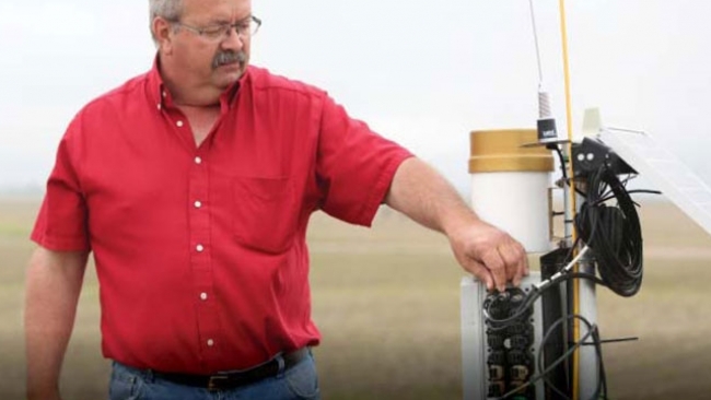
Nebraska producer Roric Paulman likes tuning into weather apps, which help him make certain on-the-go decisions a bit easier. Yet for irrigation timing decisions, that’s not enough. So Paulman, a 2015 Top Producer of the Year finalist who farms in Sutherland, turned to evapotranspiration sensors placed directly in his fields. “We each have a responsibility to these resources, whether it’s water or soil or air,†Paulman points out. “If you start now, there are some behavior-changing opportunities that can help you both environmentally and financially.â€
Source: AG Web
Tue 23 Feb 2016 at 08:12